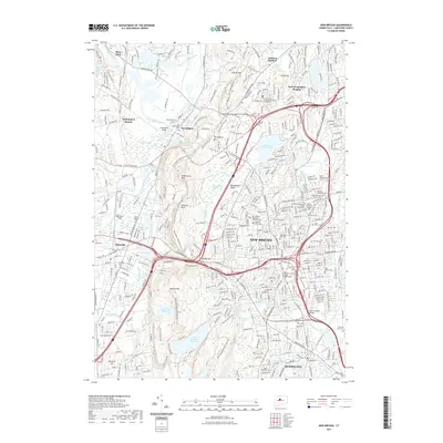
2021 Map of New Britain
USGS Topo · Published 2021About this map
New Britain and its surrounding communities are defined by a complex network of industrial heritage and steep trap rock topography. The prominent spine of the Metacomet Ridge cuts through the center of the sheet, separating the dense urban core of New Britain from the residential developments of Farmington and Plainville. This elevation is marked by distinctive peaks like Rattlesnake Mtn and Pinnacle Rock, while the lowlands are punctuated by significant water bodies such as Shuttle Meadow Reservoir and Batterson Park Pond. The area's deep-rooted community history is visible through a dense concentration of local institutions, from the Central Connecticut State University campus to numerous religious sites including Saint Josephs Ch and several heritage-specific burial grounds like the Russian Orthodox Cem and Beth Alom Cem. The Quinnipiac River and Pequabuck River provide the natural drainage for this corridor, which has long served as a vital junction in the Hartford region.
Find a feature on this map
68 named features on this map. Tap any name to fly to it.
Don’t see what you’re looking for? This feature index may not catch every label — zoom into the map to look around manually.
Map Details
Editions of this 2021 New Britain Map
This is the sole edition of this map. No revisions or reprints were ever made.
Other maps of this area

1892 · Hartford
USGS Topo · 1:62,500

1892 · Meriden
USGS Topo · 1:62,500

1892 · Granby
USGS Topo · 1:62,500

1893 · Middletown
USGS Topo · 1:62,500

1893 · Meriden
USGS Topo · 1:62,500

1906 · Farmington
USGS Topo · 1:125,000

1928 · Cromwell
USGS Topo · 1:24,000

1928 · Windsor
USGS Topo · 1:24,000

1944 · Hartford South
USGS Topo · 1:31,680

1945 · Hartford North
USGS Topo · 1:31,680