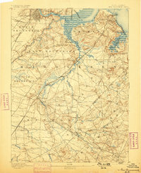
1893 Map of New Brunswick
USGS Topo · Published 1898About this map
Industrial clay production and critical rail infrastructure define the landscape of Middlesex and Monmouth counties at the close of the nineteenth century. Near Sayreville, the Edgars Clay Pits and Fireproof Building Cos. P. highlight the region's importance to early building materials manufacturing. The area is a nexus of transportation, where the Camden and Amboy Railroad and the Freehold and Jamesburgh Railroad converge at Jamesburg, connecting the interior agricultural lands and the State Reform School to the coastal hubs of South Amboy and New Brunswick. Along the southern border, the Monmouth Battle Ground serves as a prominent landmark of the American Revolution, set amidst a web of family-named settlements like Hardenberg Corners, Dunham Corners, and Robertsville. This topographic survey provides a detailed view of the water systems supporting these communities, from the Raritan River in the north to the Manalapan Brook and Matchaponix Brook in the south.
Find a feature on this map
80 named features on this map. Tap any name to fly to it.
Don’t see what you’re looking for? This feature index may not catch every label — zoom into the map to look around manually.
Map Details
Editions of this 1893 New Brunswick Map
2 editions found
Other maps of this area

1888 · Plainfield
USGS Topo · 1:62,500

1888 · Bordentown
USGS Topo · 1:62,500

1888 · New Brunswick
USGS Topo · 1:62,500

1888 · Princeton
USGS Topo · 1:62,500

1888 · Asbury Park
USGS Topo · 1:62,500

1888 · Cassville
USGS Topo · 1:62,500

1888 · Sandy Hook
USGS Topo · 1:62,500

1891 · Somerville
USGS Topo · 1:62,500

1893 · Bordentown
USGS Topo · 1:62,500

1893 · New Brunswick
USGS Topo · 1:62,500