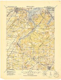
1919 Map of New Brunswick
USGS Topo · Published 1921About this map
New Brunswick and the industrial corridors of central New Jersey are captured here just after the First World War, highlighting a landscape defined by its complex rail and river networks. The Raritan River and South River serve as primary arteries for commerce, passing through established manufacturing centers like Sayreville and Milltown. To the south, the terrain shifts into a dense collection of smaller settlements and agricultural junctions, including Jamesburg and the State Reform School.
Find a feature on this map
95 named features on this map. Tap any name to fly to it.
Don’t see what you’re looking for? This feature index may not catch every label — zoom into the map to look around manually.
Map Details
Editions of this 1919 New Brunswick Map
This is the sole edition of this map. No revisions or reprints were ever made.
Other maps of this area

1888 · Plainfield
USGS Topo · 1:62,500

1888 · Bordentown
USGS Topo · 1:62,500

1888 · New Brunswick
USGS Topo · 1:62,500

1888 · Princeton
USGS Topo · 1:62,500

1888 · Asbury Park
USGS Topo · 1:62,500

1888 · Cassville
USGS Topo · 1:62,500

1888 · Sandy Hook
USGS Topo · 1:62,500

1891 · Somerville
USGS Topo · 1:62,500

1893 · Bordentown
USGS Topo · 1:62,500

1893 · New Brunswick
USGS Topo · 1:62,500