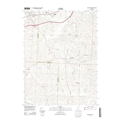
2013 Map of New Concord
USGS Topo · Published 2013About this map
New Concord and its eastern surroundings are characterized by a dense network of country roads and small communities straddling the Muskingum and Guernsey County line. The village is well-connected by the John Glenn Hwy and major thoroughfares like W Main St, reflecting its growth as a regional hub. To the south and east, the landscape transitions into a series of smaller settlements such as Claysville and Rix Mills, where life is oriented around local landmarks and water features like N Crooked Cr and Flat Run. The presence of several historic burial grounds, including E Union Cem, Zion Cem, and Cedar Cem, indicates deep-rooted family ties throughout this portion of the Ohio countryside. Modern developments such as Morgan Manor and Colonial Heights near the village core contrast with the more scattered rural layout near Luburgh Lake and Spring Lake to the northeast.
Find a feature on this map
106 named features on this map. Tap any name to fly to it.
Don’t see what you’re looking for? This feature index may not catch every label — zoom into the map to look around manually.
Map Details
Editions of this 2013 New Concord Map
This is the sole edition of this map. No revisions or reprints were ever made.
Other maps of this area

1908 · Conesville
USGS Topo · 1:62,500

1909 · Cambridge
USGS Topo · 1:62,500

1910 · Philo
USGS Topo · 1:62,500

1910 · Conesville
USGS Topo · 1:62,500

1911 · Cumberland
USGS Topo · 1:62,500

1912 · Cambridge
USGS Topo · 1:62,500

1949 · Clarksburg
USGS Topo · 1:250,000

1951 · Canton
USGS Topo · 1:250,000

1953 · Canton
USGS Topo · 1:250,000

1956 · Clarksburg
USGS Topo · 1:250,000