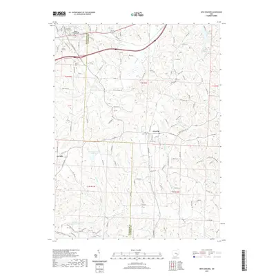
2019 Map of New Concord
USGS Topo · Published 2019About this map
Muskingum University serves as the cultural anchor for the village of New Concord, a community defined by its rolling topography and historical position along the National Road corridor. This survey illustrates the rural landscape of eastern Muskingum County, where the Muskingum and Guernsey county line bisects a network of winding waterways including Crooked Cr and its northern branch. The settlement pattern remains centered on traditional crossroads, with smaller hamlets like Claysville and Rix Mills connected by historically named routes such as Clay Pike and Rough and Ready Rd. Several local cemeteries, including East Union Cem and Cedar Cem, are scattered across the higher elevations, providing vital points of interest for genealogical research. The presence of Ohio Power Company Pond Mur-3 indicates the area's later industrial and utility development amidst the numerous runs and creeks that carve the terrain.
Find a feature on this map
53 named features on this map. Tap any name to fly to it.
Don’t see what you’re looking for? This feature index may not catch every label — zoom into the map to look around manually.
Map Details
Editions of this 2019 New Concord Map
This is the sole edition of this map. No revisions or reprints were ever made.
Other maps of this area

1908 · Conesville
USGS Topo · 1:62,500

1909 · Cambridge
USGS Topo · 1:62,500

1910 · Philo
USGS Topo · 1:62,500

1910 · Conesville
USGS Topo · 1:62,500

1911 · Cumberland
USGS Topo · 1:62,500

1912 · Cambridge
USGS Topo · 1:62,500

1949 · Clarksburg
USGS Topo · 1:250,000

1951 · Canton
USGS Topo · 1:250,000

1953 · Canton
USGS Topo · 1:250,000

1956 · Clarksburg
USGS Topo · 1:250,000