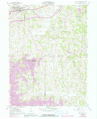
1961 Map of New Concord
USGS Topo · Published 1991About this map
Muskingum College anchors the northern portion of this landscape, situated alongside the village of New Concord just as the interstate era was reshaping eastern Ohio. The Baltimore and Ohio railroad corridor parallels the winding path of Crooked Creek, tracing a valley that defines the local topography. Further south, the rural character of Muskingum and Guernsey counties is punctuated by small settlements like Claysville and Rix Mills, which served as local hubs for the surrounding farmsteads.
Find a feature on this map
35 named features on this map. Tap any name to fly to it.
Don’t see what you’re looking for? This feature index may not catch every label — zoom into the map to look around manually.
Map Details
Editions of this 1961 New Concord Map
4 editions found
Other maps of this area

1908 · Conesville
USGS Topo · 1:62,500

1909 · Cambridge
USGS Topo · 1:62,500

1910 · Philo
USGS Topo · 1:62,500

1910 · Conesville
USGS Topo · 1:62,500

1911 · Cumberland
USGS Topo · 1:62,500

1912 · Cambridge
USGS Topo · 1:62,500

1949 · Clarksburg
USGS Topo · 1:250,000

1951 · Canton
USGS Topo · 1:250,000

1953 · Canton
USGS Topo · 1:250,000

1956 · Clarksburg
USGS Topo · 1:250,000