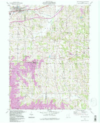
1994 Map of New Concord
USGS Topo · Published 1998About this map
Muskingum College anchors the northern landscape of this region, which straddles the boundary between Muskingum and Guernsey counties. The village of New Concord sits at the headwaters of the North Fork and Crooked Creek, a terrain characterized by the extensive footprint of the Baltimore and Ohio railroad. While the town center represents educational and civic growth, the surrounding townships of Union, Westland, and Spencer reveal an economy transitioning between agriculture and heavy industry.
Find a feature on this map
32 named features on this map. Tap any name to fly to it.
Don’t see what you’re looking for? This feature index may not catch every label — zoom into the map to look around manually.
Map Details
Editions of this 1994 New Concord Map
This is the sole edition of this map. No revisions or reprints were ever made.
Other maps of this area

1908 · Conesville
USGS Topo · 1:62,500

1909 · Cambridge
USGS Topo · 1:62,500

1910 · Philo
USGS Topo · 1:62,500

1910 · Conesville
USGS Topo · 1:62,500

1911 · Cumberland
USGS Topo · 1:62,500

1912 · Cambridge
USGS Topo · 1:62,500

1949 · Clarksburg
USGS Topo · 1:250,000

1951 · Canton
USGS Topo · 1:250,000

1953 · Canton
USGS Topo · 1:250,000

1956 · Clarksburg
USGS Topo · 1:250,000