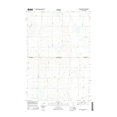
2014 Map of New Effington NW
USGS Topo · Published 2014About this map
The North Dakota-South Dakota border defines the central axis of this landscape, where the prairie transitions across state and county lines. In this section of the Lake Traverse District, the terrain is marked by the irregular depressions of Big Slough and Indian Slough, characteristic of the region’s glacial hydrology. A sparse network of section-line roads, such as Co Road 21 and 101st St SE, provides the framework for rural life. Genealogists and local researchers will find evidence of the area's cultural heritage at the Bohemian Cem and Thompson Cem, which serve as quiet landmarks of the early families who settled this borderland between Richland and Roberts counties.
Find a feature on this map
16 named features on this map. Tap any name to fly to it.
Don’t see what you’re looking for? This feature index may not catch every label — zoom into the map to look around manually.
Map Details
Editions of this 2014 New Effington NW Map
This is the sole edition of this map. No revisions or reprints were ever made.
Other maps of this area

1904 · Wahpeton
USGS Topo · 1:125,000

1907 · Wyndmere
USGS Topo · 1:125,000

1917 · New Effington
USGS Topo · 1:62,500

1953 · Milbank
USGS Topo · 1:250,000

1953 · Fargo
USGS Topo · 1:250,000

1956 · Fargo
USGS Topo · 1:250,000

1958 · Milbank
USGS Topo · 1:250,000

1964 · Hankinson
USGS Topo · 1:24,000

1964 · Hankinson SE
USGS Topo · 1:24,000
1964 · Swan Lake
USGS Topo · 1:24,000