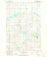
1964 Map of Swan Lake
USGS Topo · Published 1965About this map
Swan Lake and the marshy wetlands of southeast North Dakota define this landscape in the mid-1960s. The terrain is characterized by numerous small bodies of water and low-lying sloughs, including Gullys Slough and Stocks Slough, reflecting the post-glacial geology of Richland County. Human modification of the prairie is evident through the path of the Soo Line Great Northern Railroad Grade, which crosses the central portion of the sheet near the small settlement of Stiles. To the south, an Old Railroad Grade suggests a changing local transportation network as rail lines were consolidated or removed.
Find a feature on this map
17 named features on this map. Tap any name to fly to it.
Don’t see what you’re looking for? This feature index may not catch every label — zoom into the map to look around manually.
Map Details
Editions of this 1964 Swan Lake Map
This is the sole edition of this map. No revisions or reprints were ever made.
Other maps of this area

1904 · Wahpeton
USGS Topo · 1:125,000

1907 · Wyndmere
USGS Topo · 1:125,000

1917 · New Effington
USGS Topo · 1:62,500

1953 · Milbank
USGS Topo · 1:250,000

1953 · Fargo
USGS Topo · 1:250,000

1956 · Fargo
USGS Topo · 1:250,000

1958 · Milbank
USGS Topo · 1:250,000

1964 · Kreiser Lake
USGS Topo · 1:24,000

1964 · Hankinson
USGS Topo · 1:24,000

1964 · Mantador
USGS Topo · 1:24,000
Featured Places
- Elma Township, ND
- Brightwood Township, ND
- Liberty Grove Township, ND
- Moran Township, ND
- Duerr Township, ND