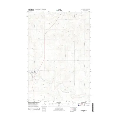
2014 Map of New England
USGS Topo · Published 2014About this map
New England serves as the primary hub in this southwestern North Dakota landscape, where the town's street grid, including Main St and McKenzie St, meets the agricultural infrastructure along Elevator Rd. The town is situated near a sweeping bend of the Cannonball River, which meanders across the southern portion of the quadrangle. North of the settlement, the terrain is defined by a system of intermittent drainage including Dead Horse Cr and Coon Cr, which carve through the high plains. A rigid section-line road network, featuring routes such as 58th St SW and 60th St SW, underscores the importance of land management and farming in Hettinger County during the early 21st century.
Find a feature on this map
13 named features on this map. Tap any name to fly to it.
Don’t see what you’re looking for? This feature index may not catch every label — zoom into the map to look around manually.
Map Details
Editions of this 2014 New England Map
This is the sole edition of this map. No revisions or reprints were ever made.
Other maps of this area

1953 · Dickinson
USGS Topo · 1:250,000

1957 · Dickinson
USGS Topo · 1:250,000

1973 · Lefor NW
USGS Topo · 1:24,000

1973 · New England NW
USGS Topo · 1:24,000

1973 · Jung Lake
USGS Topo · 1:24,000

1973 · New England
USGS Topo · 1:24,000

1973 · Lefor SW
USGS Topo · 1:24,000

1973 · Havelock
USGS Topo · 1:24,000

1973 · East Rainy Butte
USGS Topo · 1:24,000

1973 · Schefield
USGS Topo · 1:24,000