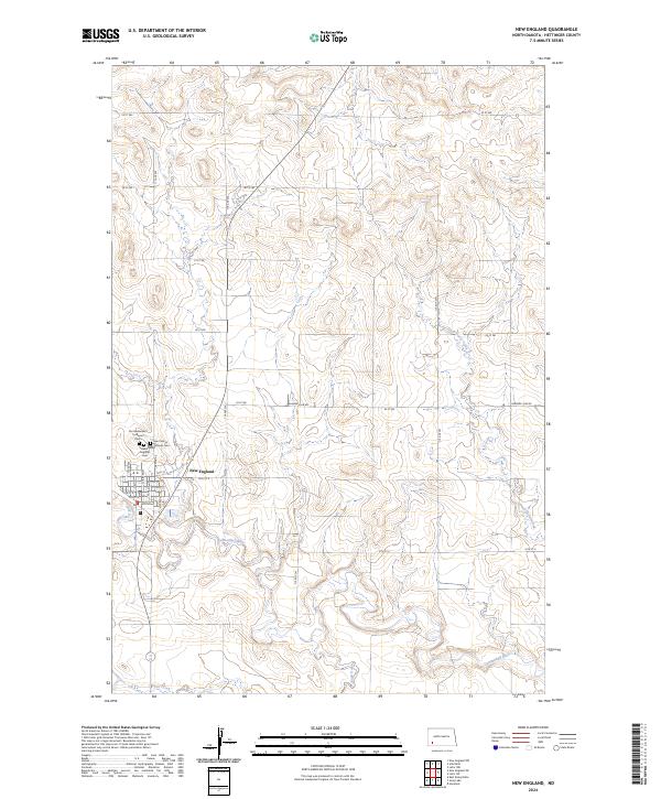
2024 Map of New England
USGS Topo · Published 2024About this map
The Cannonball River meanders through this portion of Hettinger County, serving as the central geographic feature for the prairie landscape surrounding New England. This agrarian hub is characterized by a traditional grid of residential streets including Main St and McKenzie St, providing a clear view of the town's modern footprint. The map highlights significant local heritage sites, particularly the cluster of cemeteries on the northern edge of the settlement. These include Saint Marys Catholic Cem, Our Redeemer's Lutheran Cem, and the New England Cem, which together anchor the community's genealogy. Outside the town center, the terrain is defined by a series of drainage systems like Coon Creek and Dead Horse Creek, which cut through the sections and townships of the North Dakota plains. The rural road network, including Bomber Club Rd, connects the outlying farmsteads to the commercial core.
Find a feature on this map
38 named features on this map. Tap any name to fly to it.
Don’t see what you’re looking for? This feature index may not catch every label — zoom into the map to look around manually.
Map Details
Editions of this 2024 New England Map
This is the sole edition of this map. No revisions or reprints were ever made.
Other maps of this area

1953 · Dickinson
USGS Topo · 1:250,000

1957 · Dickinson
USGS Topo · 1:250,000

1973 · Lefor NW
USGS Topo · 1:24,000

1973 · New England NW
USGS Topo · 1:24,000

1973 · Jung Lake
USGS Topo · 1:24,000

1973 · New England
USGS Topo · 1:24,000

1973 · Lefor SW
USGS Topo · 1:24,000

1973 · Havelock
USGS Topo · 1:24,000

1973 · East Rainy Butte
USGS Topo · 1:24,000

1973 · Schefield
USGS Topo · 1:24,000