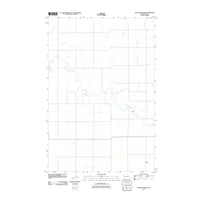
2011 Map of New England SW
USGS Topo · Published 2011About this map
The Cannonball River meanders across this rural landscape in southwestern North Dakota, defining the drainage patterns of Hettinger County at the start of the 21st century. The map illustrates a sparse, agrarian environment where the section line road network creates a rigid grid over the undulating prairie. Human presence is marked by isolated landmarks, most notably the Schmidt Cemetery in the southeastern quadrant, which serves as a vital point of reference for local genealogical research and family history. Water management on the plains is represented by the Karey Dam, a small impoundment along the river's course. This topographic record preserves the precise alignment of local roads and the natural hydrology of the Missouri Plateau region before further modern development or landscape changes occurred.
Find a feature on this map
3 named features on this map. Tap any name to fly to it.
Don’t see what you’re looking for? This feature index may not catch every label — zoom into the map to look around manually.
Map Details
Editions of this 2011 New England SW Map
This is the sole edition of this map. No revisions or reprints were ever made.
Other maps of this area

1953 · Dickinson
USGS Topo · 1:250,000

1957 · Dickinson
USGS Topo · 1:250,000

1961 · Daglum
USGS Topo · 1:62,500

1973 · New England NW
USGS Topo · 1:24,000

1973 · Jung Lake
USGS Topo · 1:24,000

1973 · New England
USGS Topo · 1:24,000

1973 · West Rainy Butte
USGS Topo · 1:24,000

1973 · East Rainy Butte
USGS Topo · 1:24,000

1973 · Schefield
USGS Topo · 1:24,000

1973 · New England SW
USGS Topo · 1:24,000