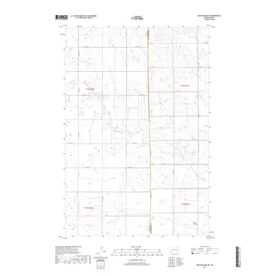
2017 Map of New England SW
USGS Topo · Published 2017About this map
The Cannonball River meanders through the heart of this southwestern North Dakota landscape, tracing a winding path across the section lines of the Missouri Plateau. This 2017 survey details a rural expanse defined by the intersection of Slope County and Hettinger County, where a grid of gravel section roads like 126th Ave SW and 55th St SW provide access to the rolling prairie. Settlement is sparse, with activity centered on isolated farmsteads and the quiet grounds of the Schmidt Cem in the southeastern corner near Coon Cr. The map illustrates a modern agricultural environment where the natural drainage of the river system remains the primary geographic feature amidst a highly organized rectilinear land system.
Find a feature on this map
21 named features on this map. Tap any name to fly to it.
Don’t see what you’re looking for? This feature index may not catch every label — zoom into the map to look around manually.
Map Details
Editions of this 2017 New England SW Map
This is the sole edition of this map. No revisions or reprints were ever made.
Other maps of this area

1953 · Dickinson
USGS Topo · 1:250,000

1957 · Dickinson
USGS Topo · 1:250,000

1961 · Daglum
USGS Topo · 1:62,500

1973 · New England NW
USGS Topo · 1:24,000

1973 · Jung Lake
USGS Topo · 1:24,000

1973 · New England
USGS Topo · 1:24,000

1973 · West Rainy Butte
USGS Topo · 1:24,000

1973 · East Rainy Butte
USGS Topo · 1:24,000

1973 · Schefield
USGS Topo · 1:24,000

1973 · New England SW
USGS Topo · 1:24,000