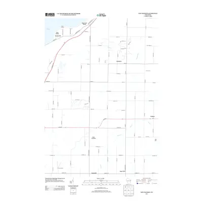
2013 Map of New Franken
USGS Topo · Published 2013About this map
Lake Michigan dominates the northwestern edge of this landscape, where the coastal bluff of Red Banks and the lookout at Point Comfort overlook the water. The inland terrain is defined by a dense grid of farm-to-market roads and the headwaters of the Kewaunee River, which drains the agricultural heartland of Brown County. Scattered throughout this rural area are small crossroads communities and family-run operations like Cornette Dairy and Sugar Maple Dairy, reflecting the region's enduring dairy farming heritage. The settlement pattern is anchored by the historic village of New Franken at the junction of Wi-54 and N New Franken Rd. To the south, the community of Sugar Bush sits along the southern map boundary, while the Nicolet Airport serves the local aviation needs of this well-connected agricultural corridor near the Green Bay shoreline.
Find a feature on this map
80 named features on this map. Tap any name to fly to it.
Don’t see what you’re looking for? This feature index may not catch every label — zoom into the map to look around manually.
Map Details
Editions of this 2013 New Franken Map
This is the sole edition of this map. No revisions or reprints were ever made.
Other maps of this area

1952 · Casco
USGS Topo · 1:62,500

1954 · Kewaunee
USGS Topo · 1:62,500

1954 · Denmark
USGS Topo · 1:62,500

1954 · New Franken
USGS Topo · 1:62,500

1954 · Green Bay East
USGS Topo · 1:24,000

1954 · Manitowoc
USGS Topo · 1:250,000

1954 · Bellevue
USGS Topo · 1:24,000

1958 · Manitowoc
USGS Topo · 1:250,000
1974 · Little Tail Point
USGS Topo · 1:24,000

1978 · Namur
USGS Topo · 1:24,000