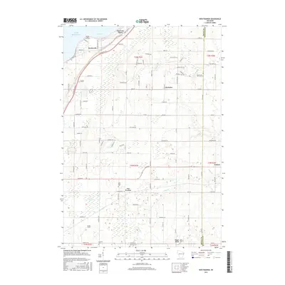
2015 Map of New Franken
USGS Topo · Published 2015About this map
The coastal waters of Lake Michigan meet the agricultural interior of Brown and Kewaunee Counties at Point Comfort. This transition is defined by the steep bluffs of Green Bay and the lowland drainages of the New Franken Swamp. The landscape reflects a deeply rooted rural community, organized around early crossroads settlements like New Franken and Champion. The density of religious and family landmarks is particularly striking, with numerous burial grounds such as Saint Kilian Cem, Saint Marys Cem, and the Seventh-day Adventist Cem serving as anchors for the local genealogy. Transport in the region is a mix of traditional farm-to-market roads and specialized hubs like Nicolet Airport, while the northern reaches include seasonal retreats at Edgewater Beach and Benderville. Waterways like the Kewaunee River and Gilson Cr carve through the glacial till, shaping the boundaries of local townships.
Find a feature on this map
102 named features on this map. Tap any name to fly to it.
Don’t see what you’re looking for? This feature index may not catch every label — zoom into the map to look around manually.
Map Details
Editions of this 2015 New Franken Map
This is the sole edition of this map. No revisions or reprints were ever made.
Other maps of this area

1952 · Casco
USGS Topo · 1:62,500

1954 · Kewaunee
USGS Topo · 1:62,500

1954 · Denmark
USGS Topo · 1:62,500

1954 · New Franken
USGS Topo · 1:62,500

1954 · Green Bay East
USGS Topo · 1:24,000

1954 · Manitowoc
USGS Topo · 1:250,000

1954 · Bellevue
USGS Topo · 1:24,000

1958 · Manitowoc
USGS Topo · 1:250,000
1974 · Little Tail Point
USGS Topo · 1:24,000

1978 · Namur
USGS Topo · 1:24,000