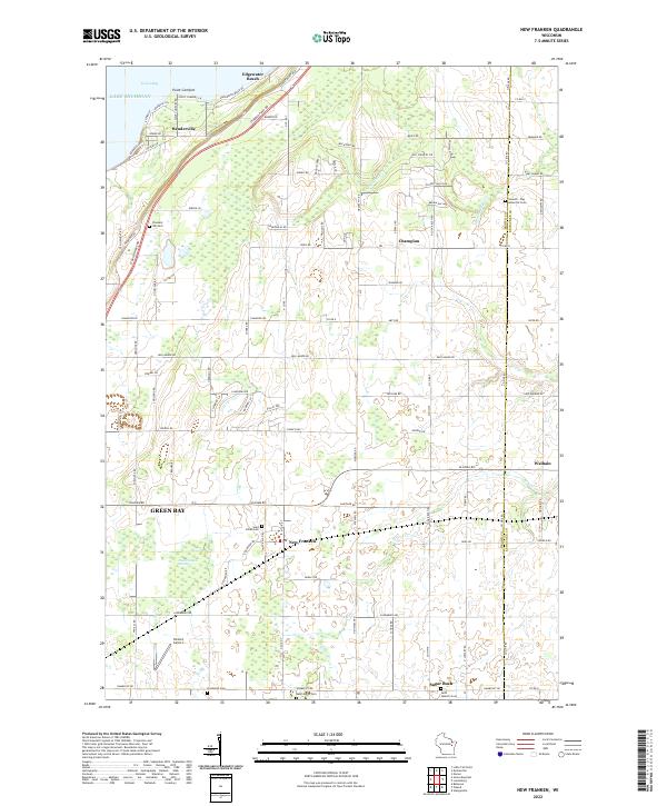
2022 Map of New Franken
USGS Topo · Published 2022About this map
Green Bay and the shoreline of Lake Michigan define the northwestern corner of this Brown County landscape, where the coastal community of Benderville sits at the foot of Point Comfort. Moving inland, the terrain is shaped by the headwaters of the Kewaunee River and School Creek, creating a mix of agricultural plots and wetlands like the New Franken Swamp. The settlement pattern reflects a deeply rooted rural community, with small villages such as New Franken, Sugar Bush, and Champion serving as local hubs. Genealogists will find a high density of parish burial sites across the township lines, including Saint Kilian Cem, Saint Marys Cem, and Saint Huberts Cem. Transportation is anchored by a grid of county roads and the presence of the Nicolet Airport south of the swamp, illustrating the modern rural character of the region near the Kewaunee County line.
Find a feature on this map
108 named features on this map. Tap any name to fly to it.
Don’t see what you’re looking for? This feature index may not catch every label — zoom into the map to look around manually.
Map Details
Editions of this 2022 New Franken Map
This is the sole edition of this map. No revisions or reprints were ever made.
Other maps of this area

1952 · Casco
USGS Topo · 1:62,500

1954 · Kewaunee
USGS Topo · 1:62,500

1954 · Denmark
USGS Topo · 1:62,500

1954 · New Franken
USGS Topo · 1:62,500

1954 · Green Bay East
USGS Topo · 1:24,000

1954 · Manitowoc
USGS Topo · 1:250,000

1954 · Bellevue
USGS Topo · 1:24,000

1958 · Manitowoc
USGS Topo · 1:250,000
1974 · Little Tail Point
USGS Topo · 1:24,000

1978 · Namur
USGS Topo · 1:24,000