
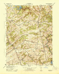
1944 Map of New Freedom
USGS Topo · Published 1944About this map
The Mason and Dixon Line serves as the central anchor for this mid-century survey, dividing the landscape between York County, Pennsylvania, and Baltimore County, Maryland. This borderland is defined by a dense network of country schools and rural congregations, including the notable Summit Grove Camp Meeting near New Freedom and localized landmarks like Gerbricks School and Mt Zion Church. The transition from the high ground of the rail corridor to the deeply carved valleys of the Little Falls and Bee Tree Run illustrates a geography still deeply connected to its water-driven history.
Find a feature on this map
44 named features on this map. Tap any name to fly to it.
Don’t see what you’re looking for? This feature index may not catch every label — zoom into the map to look around manually.
Map Details
Editions of this 1944 New Freedom Map
This is the sole edition of this map. No revisions or reprints were ever made.
Other maps of this area

1900 · Parkton
USGS Topo · 1:62,500

1902 · Parkton
USGS Topo · 1:62,500

1905 · Westminster
USGS Topo · 1:62,500

1908 · York
USGS Topo · 1:62,500

1910 · York
USGS Topo · 1:62,500

1920 · Hanover
USGS Topo · 1:62,500

1922 · Hanover
USGS Topo · 1:62,500

1944 · Hampstead
USGS Topo · 1:31,680
1944 · Hereford
USGS Topo · 1:31,680

1944 · Norrisville
USGS Topo · 1:31,680