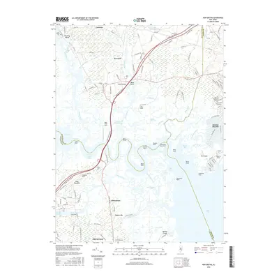
2016 Map of New Gretna
USGS Topo · Published 2016About this map
New Gretna and the expansive wetlands of the Mullica River basin define this coastal Atlantic and Burlington County landscape. The area is a complex network of saltwater marshes and tidal thoroughfares, where the Garden State Parkway cuts a modern path across established water bodies like the Wading River and Bass River. For genealogists, the map preserves the locations of several community burial grounds, including Hillside Cem, Miller Cem, and Leek-McKeen Cem.
Find a feature on this map
138 named features on this map. Tap any name to fly to it.
Don’t see what you’re looking for? This feature index may not catch every label — zoom into the map to look around manually.
Map Details
Editions of this 2016 New Gretna Map
This is the sole edition of this map. No revisions or reprints were ever made.
Other maps of this area

1887 · Atlantic City
USGS Topo · 1:62,500

1888 · Little Egg Harbor
USGS Topo · 1:62,500

1890 · Great Egg Harbor
USGS Topo · 1:62,500

1890 · Mullica
USGS Topo · 1:62,500

1893 · Great Egg Harbor
USGS Topo · 1:62,500

1893 · Little Egg Harbor
USGS Topo · 1:62,500

1894 · Atlantic City
USGS Topo · 1:62,500

1894 · Mullica
USGS Topo · 1:62,500

1898 · Mullica
USGS Topo · 1:62,500

1900 · Rancocas
USGS Topo · 1:125,000
Featured Places
- Galloway Township, NJ
- Little Egg Harbor Township, NJ
- Bass River Township, NJ
- Port Republic, NJ
- Washington Township, NJ