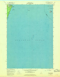
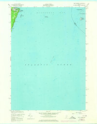
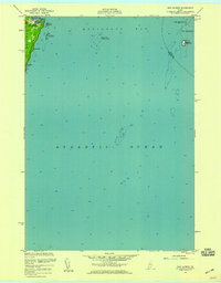
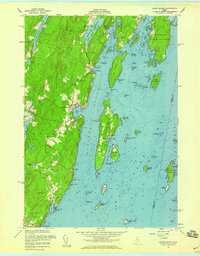
1955 Map of New Harbor
USGS Topo · Published 1968About this map
The coastal village of New Harbor serves as the focal point for this mid-century maritime survey, situated along the eastern edge of Pemaquid Neck in Lincoln County. The map details a landscape where the granite-bound shoreline meets the Atlantic Ocean, including sheltered inlets like Back Cove and the southern reach of Pumpkin Cove. Inland, Lookout Hill provides a vantage point over the rugged peninsula, while the hydrographic data reveals the complexity of the nearby waters.
Find a feature on this map
19 named features on this map. Tap any name to fly to it.
Don’t see what you’re looking for? This feature index may not catch every label — zoom into the map to look around manually.
Map Details
Editions of this 1955 New Harbor Map
3 editions found
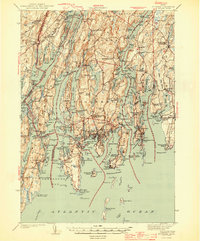
Other maps of this area

1893 · Boothbay
USGS Topo · 1:62,500

1904 · Monhegan
USGS Topo · 1:62,500

1906 · Monhegan
USGS Topo · 1:62,500

1941 · Boothbay
USGS Topo · 1:62,500

1943 · Boothbay
USGS Topo · 1:62,500
1944 · Boothbay
USGS Topo · 1:62,500

1948 · Bath
USGS Topo · 1:250,000
1955 · New Harbor
USGS Topo · 1:24,000
1955 · Louds Island
USGS Topo · 1:24,000
1955 · Monhegan
USGS Topo · 1:24,000