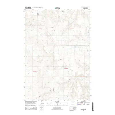
2015 Map of New Haven
USGS Topo · Published 2015About this map
New Haven anchors this portion of Crook County, positioned near the intersection of New Haven Rd and Mule Creek Rd. The landscape is defined by an intricate network of drainage systems, including Wallace Draw, Gumbo Draw, and Long Draw, alongside several seasonal watercourses such as Hulett Cr and Poison Cr. These geographic features suggest a ranching-focused environment where water management is critical, evidenced by the Julius Hayber Reservoir located along Barnard Cr. For those tracing local history, the New Haven Cem provides a specific point of genealogical interest south of the primary settlement area. The terrain transitions into more pronounced relief at Barlow Canyon and Sawmill Gulch, reflecting the varied topography of this Wyoming ranching district.
Find a feature on this map
23 named features on this map. Tap any name to fly to it.
Don’t see what you’re looking for? This feature index may not catch every label — zoom into the map to look around manually.
Map Details
Editions of this 2015 New Haven Map
This is the sole edition of this map. No revisions or reprints were ever made.
Other maps of this area

1905 · Devils Tower
USGS Topo · 1:125,000

1954 · Strawberry Hill
USGS Topo · 1:24,000

1954 · Storm Hill
USGS Topo · 1:24,000

1954 · Missouri Buttes
USGS Topo · 1:24,000

1954 · Gillette
USGS Topo · 1:250,000

1955 · Devils Tower
USGS Topo · 1:62,500

1955 · Gillette
USGS Topo · 1:250,000

1957 · Oshoto
USGS Topo · 1:62,500

1957 · Seely
USGS Topo · 1:62,500

1957 · Cedar Ridge
USGS Topo · 1:62,500