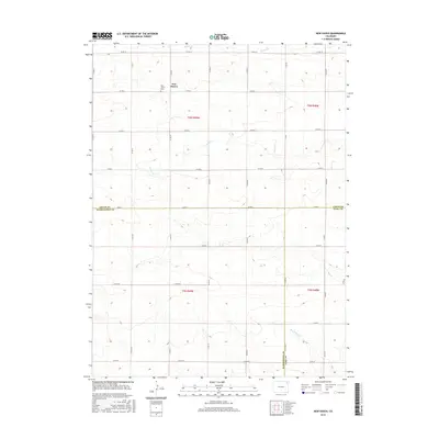
2016 Map of New Haven
USGS Topo · Published 2016About this map
New Haven sits at the intersection of several county roads in the northeastern plains of Colorado, representing a quiet agricultural crossroads near the border of Logan, Washington, and Yuma counties. This 2016 survey highlights the sparse, grid-patterned infrastructure typical of the region's high plains ranching and farming landscape. The New Haven Cemetery is the primary landmark for local history, serving as a focal point for the surrounding community. Drainage in this arid environment is defined by seasonal watercourses such as Coyote Creek, Patent Creek, and Red Willow Creek, which carve subtle relief into the terrain. The map meticulously documents the Public Land Survey System divisions, including Township 6 North, Range 49 West, and the intersecting county line between Logan and Washington counties.
Find a feature on this map
36 named features on this map. Tap any name to fly to it.
Don’t see what you’re looking for? This feature index may not catch every label — zoom into the map to look around manually.
Map Details
Editions of this 2016 New Haven Map
This is the sole edition of this map. No revisions or reprints were ever made.
Other maps of this area

1954 · Sterling
USGS Topo · 1:250,000

1958 · Sterling
USGS Topo · 1:250,000

1972 · Clarkville
USGS Topo · 1:24,000

1972 · New Haven
USGS Topo · 1:24,000

1972 · Glacken Hill
USGS Topo · 1:24,000

1972 · St Petersburg
USGS Topo · 1:24,000

1972 · Rockland
USGS Topo · 1:24,000

1972 · Lone Star
USGS Topo · 1:24,000

1972 · Clarkville SW
USGS Topo · 1:24,000

1972 · Leroy
USGS Topo · 1:24,000