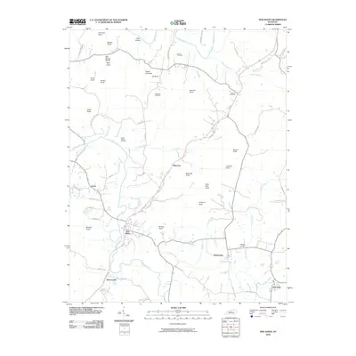
2010 Map of New Haven
USGS Topo · Published 2010About this map
New Haven and its surrounding Nelson County settlements are defined by a landscape of prominent knobs and winding waterways in this 2010 survey. The Rolling Fork river snakes through the southern half of the quadrangle, passing near Athertonville and Lyons. The topography is particularly striking due to a series of named heights such as Bull Run Knob, Blue Gap Knob, and Potato Hill Knob, which overlook the agricultural valleys below.
Find a feature on this map
64 named features on this map. Tap any name to fly to it.
Don’t see what you’re looking for? This feature index may not catch every label — zoom into the map to look around manually.
Map Details
Editions of this 2010 New Haven Map
This is the sole edition of this map. No revisions or reprints were ever made.
Other maps of this area

1949 · Cravens
USGS Topo · 1:24,000

1949 · Shepherdsville
USGS Topo · 1:62,500

1953 · Howardstown
USGS Topo · 1:24,000

1953 · Loretto
USGS Topo · 1:24,000

1953 · Nelsonville
USGS Topo · 1:24,000

1953 · Bardstown
USGS Topo · 1:24,000

1953 · New Haven
USGS Topo · 1:24,000
1953 · Hodgenville
USGS Topo · 1:24,000

1953 · Raywick
USGS Topo · 1:24,000

1957 · Winchester
USGS Topo · 1:250,000