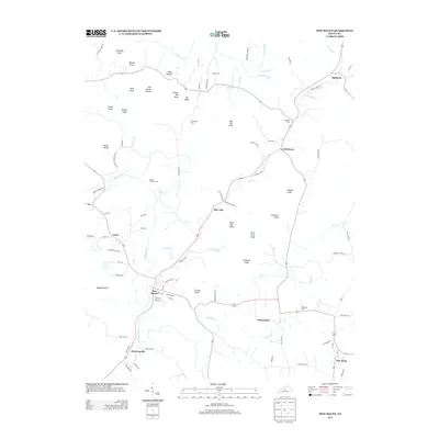
2013 Map of New Haven
USGS Topo · Published 2013About this map
The Rolling Fork and Beech Fork rivers frame this portion of Nelson County, where the landscape transitions into the distinctive knobs of central Kentucky. The town of New Haven serves as a central hub, surrounded by smaller historical settlements such as Athertonville, Gethsemane, and New Hope. The terrain is defined by prominent elevations including Blue Gap Knob, Forty Acre Knob, and Troutman Knob, creating a geography of narrow hollows like Potts Hollow and Salt Spring Hollow. Local family history is preserved through numerous small burial grounds, including the Beeler Vittitow Cem, Vowles Cem, and Pottinger Cem. The road network, featuring routes like Bowling Pike Rd and Vittitow Ford Rd, follows the natural contours of the river valleys and gaps, reflecting a long-standing pattern of travel and settlement in this knob country.
Find a feature on this map
92 named features on this map. Tap any name to fly to it.
Don’t see what you’re looking for? This feature index may not catch every label — zoom into the map to look around manually.
Map Details
Editions of this 2013 New Haven Map
This is the sole edition of this map. No revisions or reprints were ever made.
Other maps of this area

1949 · Cravens
USGS Topo · 1:24,000

1949 · Shepherdsville
USGS Topo · 1:62,500

1953 · Howardstown
USGS Topo · 1:24,000

1953 · Loretto
USGS Topo · 1:24,000

1953 · Nelsonville
USGS Topo · 1:24,000

1953 · Bardstown
USGS Topo · 1:24,000

1953 · New Haven
USGS Topo · 1:24,000
1953 · Hodgenville
USGS Topo · 1:24,000

1953 · Raywick
USGS Topo · 1:24,000

1957 · Winchester
USGS Topo · 1:250,000