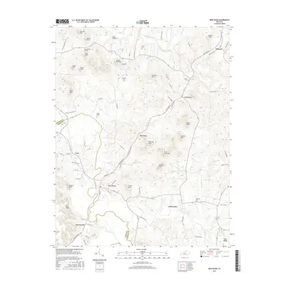
2016 Map of New Haven
USGS Topo · Published 2016About this map
New Haven serves as the primary hub of this landscape where Nelson and LaRue counties meet, situated at the junction of the Rolling Fork and Knob Cr. The area is defined by its distinct knobs and hollows, with landmarks like Potato Hill Knob, Buzzard Roost, and Forty Acre Knob rising above the river valleys. To the southeast, the community of Gethsemane sits near Pottinger Cr, while Athertonville marks the southern reach of the survey.
Find a feature on this map
88 named features on this map. Tap any name to fly to it.
Don’t see what you’re looking for? This feature index may not catch every label — zoom into the map to look around manually.
Map Details
Editions of this 2016 New Haven Map
This is the sole edition of this map. No revisions or reprints were ever made.
Other maps of this area

1949 · Cravens
USGS Topo · 1:24,000

1949 · Shepherdsville
USGS Topo · 1:62,500

1953 · Howardstown
USGS Topo · 1:24,000

1953 · Loretto
USGS Topo · 1:24,000

1953 · Nelsonville
USGS Topo · 1:24,000

1953 · Bardstown
USGS Topo · 1:24,000

1953 · New Haven
USGS Topo · 1:24,000
1953 · Hodgenville
USGS Topo · 1:24,000

1953 · Raywick
USGS Topo · 1:24,000

1957 · Winchester
USGS Topo · 1:250,000