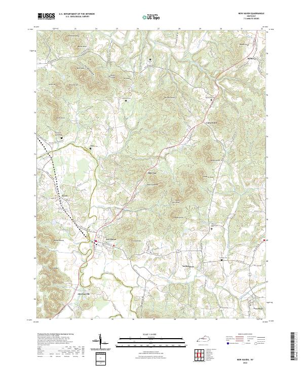
2022 Map of New Haven
USGS Topo · Published 2022About this map
New Haven sits near the confluence of Rolling Fork and Pottinger Cr, serving as a central hub in a landscape defined by prominent knobs and narrow creek valleys. The area is marked by a deep Catholic history, anchored by the Abbey of Gethsemani Cem and the nearby settlement of Gethsemane. These religious and community foundations are mirrored by family-named landmarks such as Beeler - Vittitow Cem and Marshall Cem, which provide significant data points for genealogical research in this part of Kentucky.
Find a feature on this map
53 named features on this map. Tap any name to fly to it.
Don’t see what you’re looking for? This feature index may not catch every label — zoom into the map to look around manually.
Map Details
Editions of this 2022 New Haven Map
This is the sole edition of this map. No revisions or reprints were ever made.
Other maps of this area

1949 · Cravens
USGS Topo · 1:24,000

1949 · Shepherdsville
USGS Topo · 1:62,500

1953 · Howardstown
USGS Topo · 1:24,000

1953 · Loretto
USGS Topo · 1:24,000

1953 · Nelsonville
USGS Topo · 1:24,000

1953 · Bardstown
USGS Topo · 1:24,000

1953 · New Haven
USGS Topo · 1:24,000
1953 · Hodgenville
USGS Topo · 1:24,000

1953 · Raywick
USGS Topo · 1:24,000

1957 · Winchester
USGS Topo · 1:250,000