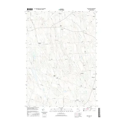
2016 Map of New Haven
USGS Topo · Published 2016About this map
New Haven serves as the central hub of this 2016 landscape, where local routes like Co Rte 104 intersect with historical burial grounds such as New Haven Rural Cem. The geography is defined by a series of low-lying wetlands and creek systems, notably Lilly Marsh and Mud Pond, which drain into Catfish Cr and Butterfly Cr. This pattern of drainage and marshland dictated the placement of small agricultural settlements and hamlets throughout the 21st century, from North Volney in the south to Demster in the north.
Find a feature on this map
78 named features on this map. Tap any name to fly to it.
Don’t see what you’re looking for? This feature index may not catch every label — zoom into the map to look around manually.
Map Details
Editions of this 2016 New Haven Map
This is the sole edition of this map. No revisions or reprints were ever made.
Other maps of this area

1895 · Pulaski
USGS Topo · 1:62,500

1900 · Fulton
USGS Topo · 1:62,500

1905 · Mexico
USGS Topo · 1:62,500

1943 · Pulaski
USGS Topo · 1:31,680

1943 · Oswego East
USGS Topo · 1:31,680

1943 · New Haven
USGS Topo · 1:31,680

1943 · Texas
USGS Topo · 1:31,680

1943 · Mexico
USGS Topo · 1:31,680

1943 · Pennellville
USGS Topo · 1:31,680

1943 · West Of Texas
USGS Topo · 1:31,680