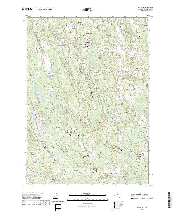
2023 Map of New Haven
USGS Topo · Published 2023About this map
Catfish Creek and Butterfly Creek define the drainage of this interior Oswego County landscape, where the wetland expanse of Lily Marsh sits south of South New Haven. The map reveals a network of hamlets and rural crossroads connected by an intricate system of county roads, showing the persistent 19th-century settlement pattern into the modern era. Small community hubs like Demster, Sala, and Vermilion anchor the landscape, each often marked by its local burial ground. Genealogists and local historians will find significant value in the distribution of family and community landmarks, including Arthur Cem, Haven Rural Cem, and Sayles Corners Cem. The terrain is characterized by subtle elevations such as Mullen Hill and various ponds like Mud Pond, illustrating the glacial topography typical of the region near the eastern shores of Lake Ontario.
Find a feature on this map
82 named features on this map. Tap any name to fly to it.
Don’t see what you’re looking for? This feature index may not catch every label — zoom into the map to look around manually.
Map Details
Editions of this 2023 New Haven Map
This is the sole edition of this map. No revisions or reprints were ever made.
Other maps of this area

1895 · Pulaski
USGS Topo · 1:62,500

1900 · Fulton
USGS Topo · 1:62,500

1905 · Mexico
USGS Topo · 1:62,500

1943 · Pulaski
USGS Topo · 1:31,680

1943 · Oswego East
USGS Topo · 1:31,680

1943 · New Haven
USGS Topo · 1:31,680

1943 · Texas
USGS Topo · 1:31,680

1943 · Mexico
USGS Topo · 1:31,680

1943 · Pennellville
USGS Topo · 1:31,680

1943 · West Of Texas
USGS Topo · 1:31,680