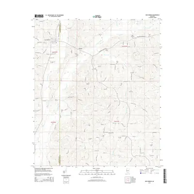
2015 Map of New Hebron
USGS Topo · Published 2015About this map
New Hebron and Hebron anchor this rural landscape along the boundary of Lawrence and Jefferson Davis Counties. The terrain is defined by a dense network of tributaries including E Prong Silver Cr, W Prong Silver Cr, and Fiddlers Cr, which converge to form Silver Cr in the south. This area is notably dense with family and community burial grounds, offering significant value for genealogical research. Named landmarks such as Stater Cem, North Silver Creek Cem, and Zion Hill Cem are distributed across the countryside, often situated near small crossroads or local churches like Galilee Ch. The road network, featuring routes like Bouie Ferry Rd and New Hebron Janesville Rd, follows the ridges between the numerous hollows, such as Hooker Hollow, reflecting a long-standing settlement pattern adapted to the local topography.
Find a feature on this map
109 named features on this map. Tap any name to fly to it.
Don’t see what you’re looking for? This feature index may not catch every label — zoom into the map to look around manually.
Map Details
Editions of this 2015 New Hebron Map
This is the sole edition of this map. No revisions or reprints were ever made.
Other maps of this area

1953 · Hattiesburg
USGS Topo · 1:250,000

1953 · Natchez
USGS Topo · 1:250,000

1956 · Natchez
USGS Topo · 1:250,000

1958 · Hattiesburg
USGS Topo · 1:250,000

1959 · Natchez
USGS Topo · 1:250,000

1970 · Prentiss West
USGS Topo · 1:24,000

1970 · Monticello
USGS Topo · 1:24,000

1970 · New Hebron
USGS Topo · 1:24,000

1970 · Prentiss East
USGS Topo · 1:24,000

1970 · Mount Carmel
USGS Topo · 1:24,000