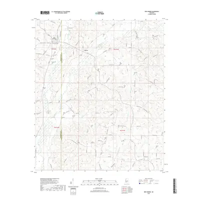
2018 Map of New Hebron
USGS Topo · Published 2018About this map
New Hebron and Hebron serve as the primary hubs in this south-central Mississippi landscape, where the headwaters of Silver Creek divide into western and eastern prongs. The terrain is defined by a dense concentration of family and community burial sites, which suggest a deeply rooted rural population. Genealogists can trace significant local history through landmarks such as Dampeer Cem, Drummonds Cem, and Zion Hill Cem. The boundary between Lawrence and Jefferson Davis counties runs through the heart of the map, following a path that intersects several small tributaries like Fiddlers Creek and Hutchens Branch. This 2018 survey reveals a landscape still largely structured around its natural drainages and traditional road networks, providing a clear view of the area's ongoing rural character and historical family settlements.
Find a feature on this map
112 named features on this map. Tap any name to fly to it.
Don’t see what you’re looking for? This feature index may not catch every label — zoom into the map to look around manually.
Map Details
Editions of this 2018 New Hebron Map
This is the sole edition of this map. No revisions or reprints were ever made.
Other maps of this area

1953 · Hattiesburg
USGS Topo · 1:250,000

1953 · Natchez
USGS Topo · 1:250,000

1956 · Natchez
USGS Topo · 1:250,000

1958 · Hattiesburg
USGS Topo · 1:250,000

1959 · Natchez
USGS Topo · 1:250,000

1970 · Prentiss West
USGS Topo · 1:24,000

1970 · Monticello
USGS Topo · 1:24,000

1970 · New Hebron
USGS Topo · 1:24,000

1970 · Prentiss East
USGS Topo · 1:24,000

1970 · Mount Carmel
USGS Topo · 1:24,000