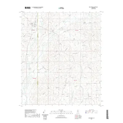
2020 Map of New Hebron
USGS Topo · Published 2020About this map
New Hebron and the smaller community of Hebron anchor this landscape along the border of Lawrence and Jefferson Davis counties. The terrain is defined by the complex drainage of Silver Creek, with several major tributaries including W Prong Silver Cr, E Prong Silver Cr, and Fiddlers Cr carving through the countryside. This map offers an exceptional look at local family history and genealogy, preserving the locations of over two dozen burial grounds. Many are associated with early settlements or family names, such as North Silver Creek Cem, Galilee Cem, Hartzog Cem, and Old Mobley Cem. The proximity of places like Zion Hill Cem and Spring Hill Cem suggests a rural social structure centered around local congregations and crossroads that persists into the modern era.
Find a feature on this map
86 named features on this map. Tap any name to fly to it.
Don’t see what you’re looking for? This feature index may not catch every label — zoom into the map to look around manually.
Map Details
Editions of this 2020 New Hebron Map
This is the sole edition of this map. No revisions or reprints were ever made.
Other maps of this area

1953 · Hattiesburg
USGS Topo · 1:250,000

1953 · Natchez
USGS Topo · 1:250,000

1956 · Natchez
USGS Topo · 1:250,000

1958 · Hattiesburg
USGS Topo · 1:250,000

1959 · Natchez
USGS Topo · 1:250,000

1970 · Prentiss West
USGS Topo · 1:24,000

1970 · Monticello
USGS Topo · 1:24,000

1970 · New Hebron
USGS Topo · 1:24,000

1970 · Prentiss East
USGS Topo · 1:24,000

1970 · Mount Carmel
USGS Topo · 1:24,000