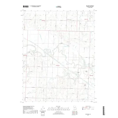
2017 Map of New Home
USGS Topo · Published 2017About this map
The Marais des Cygnes River meanders through the central Bates County landscape, defining the character of this rural Missouri region. The intricate waterway system includes distinctive features like Big Shoe Bend and Double S Bend, while the engineering of the Bates County Drainage Ditch and its associated lateral ditches, such as Lateral Ditch Number 2, illustrates long-term efforts to manage the river's floodplain for agriculture.
Find a feature on this map
70 named features on this map. Tap any name to fly to it.
Don’t see what you’re looking for? This feature index may not catch every label — zoom into the map to look around manually.
Map Details
Editions of this 2017 New Home Map
This is the sole edition of this map. No revisions or reprints were ever made.
Other maps of this area

1887 · Butler
USGS Topo · 1:125,000

1887 · Mound City
USGS Topo · 1:125,000

1893 · Mound City
USGS Topo · 1:125,000

1894 · Butler
USGS Topo · 1:125,000

1936 · Rich Hill
USGS Topo · 1:24,000

1937 · New Home
USGS Topo · 1:24,000

1938 · Worland
USGS Topo · 1:24,000

1940 · Worland
USGS Topo · 1:24,000

1940 · Hume
USGS Topo · 1:24,000

1942 · Hume
USGS Topo · 1:24,000