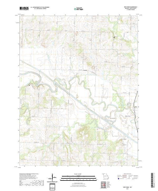
2021 Map of New Home
USGS Topo · Published 2021About this map
The Marais des Cygnes River meanders through the heart of this Bates County landscape, defining the local geography with its dramatic oxbows like Big Shoe Bend and Double S Bend. This modern survey reveals a highly managed hydrological system where the main river course is supplemented by the extensive Bates County Drainage Ditch and several engineered channels, including Lateral Ditch Number 2 and Lateral Ditch Number 3. These modifications reflect a long-standing regional effort to control the floodplain for agricultural use.
Find a feature on this map
62 named features on this map. Tap any name to fly to it.
Don’t see what you’re looking for? This feature index may not catch every label — zoom into the map to look around manually.
Map Details
Editions of this 2021 New Home Map
This is the sole edition of this map. No revisions or reprints were ever made.
Other maps of this area

1887 · Butler
USGS Topo · 1:125,000

1887 · Mound City
USGS Topo · 1:125,000

1893 · Mound City
USGS Topo · 1:125,000

1894 · Butler
USGS Topo · 1:125,000

1936 · Rich Hill
USGS Topo · 1:24,000

1937 · New Home
USGS Topo · 1:24,000

1938 · Worland
USGS Topo · 1:24,000

1940 · Worland
USGS Topo · 1:24,000

1940 · Hume
USGS Topo · 1:24,000

1942 · Hume
USGS Topo · 1:24,000