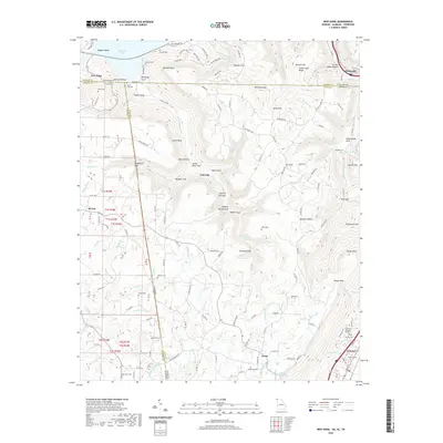
2020 Map of New Home
USGS Topo · Published 2020About this map
Sand Mountain dominates this tri-state border region, where the steep escarpments of the Cumberland Plateau meet the winding waters of Nickajack Lake. The landscape is defined by deep incisions in the plateau known as gulfs, such as Pyburn Gulf and Castle Rock Gulf, which create a complex system of drainage into Cole City Creek and Reeves Creek. Small settlements like Cole City and New Home are tucked into the valleys and along the ridge tops, illustrating the dispersed rural settlement pattern of the southern Appalachians.
Find a feature on this map
141 named features on this map. Tap any name to fly to it.
Don’t see what you’re looking for? This feature index may not catch every label — zoom into the map to look around manually.
Map Details
Editions of this 2020 New Home Map
This is the sole edition of this map. No revisions or reprints were ever made.
Other maps of this area

1886 · Ringgold
USGS Topo · 1:125,000

1886 · Stevenson
USGS Topo · 1:125,000

1888 · Chattanooga
USGS Topo · 1:125,000

1892 · Ringgold
USGS Topo · 1:125,000

1892 · Stevenson
USGS Topo · 1:125,000

1893 · Chattanooga
USGS Topo · 1:125,000

1895 · Stevenson
USGS Topo · 1:125,000

1895 · Sewanee
USGS Topo · 1:125,000

1935 · Durham
USGS Topo · 1:24,000

1936 · Trenton
USGS Topo · 1:24,000