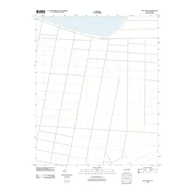
2010 Map of New Lake NW
USGS Topo · Published 2010About this map
Phelps Lake dominates the northern horizon of this coastal plain landscape, where a precise grid of drainage canals and access roads defines the agricultural territory of Washington County. This survey captures the land-use patterns of the early 21st century, showing a highly engineered network of fields south of the shoreline. Human activity is concentrated along the lake margin via Shore Dr, while the interior is partitioned by long, straight rural routes like N.C. 1348. The map illustrates the specialized water management systems required to maintain these low-lying lands for cultivation, with numerous unnamed canals intersecting the primary thoroughfares.
Find a feature on this map
3 named features on this map. Tap any name to fly to it.
Don’t see what you’re looking for? This feature index may not catch every label — zoom into the map to look around manually.
Map Details
Editions of this 2010 New Lake NW Map
This is the sole edition of this map. No revisions or reprints were ever made.
Other maps of this area

1914 · Belhaven
USGS Topo · 1:48,000

1916 · Belhaven
USGS Topo · 1:62,500

1943 · Columbia
USGS Topo · 1:125,000

1943 · Plymouth
USGS Topo · 1:125,000

1951 · Belhaven
USGS Topo · 1:24,000

1951 · Ponzer
USGS Topo · 1:24,000

1951 · New Lake SE
USGS Topo · 1:24,000

1953 · Rocky Mount
USGS Topo · 1:250,000

1954 · Rocky Mount
USGS Topo · 1:250,000

1954 · Roper South
USGS Topo · 1:24,000