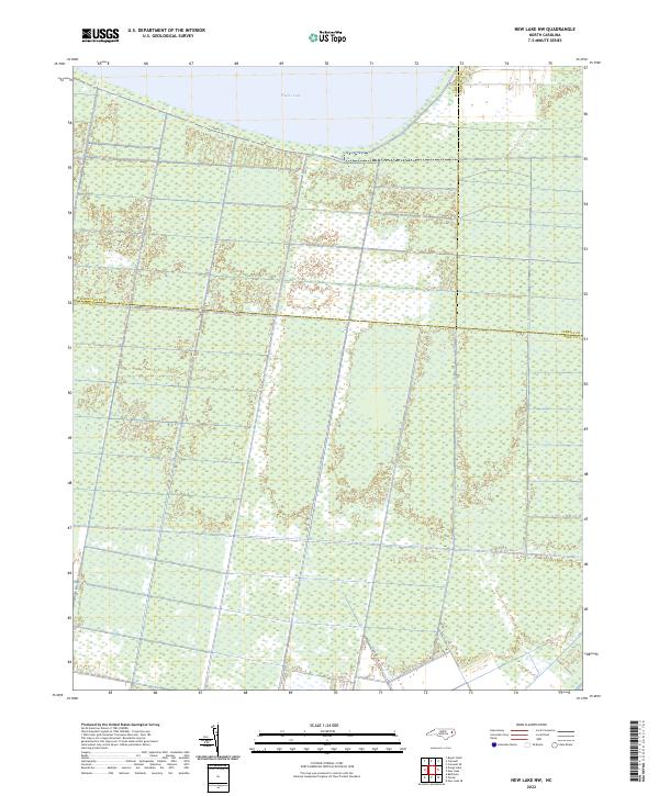
2022 Map of New Lake NW
USGS Topo · Published 2022About this map
Phelps Lake dominates the northern horizon of this coastal plain landscape, where the waters of North Carolina's second-largest natural lake meet a dense network of wetlands. The map illustrates a highly structured drainage pattern, with countless unnamed canals and ditches cutting through the low-lying terrain to manage the water levels of this ancient pocosin environment. This 2022 survey captures the modern boundary lines where Washington, Tyrrell, and Hyde counties converge amidst the saturated soils. Shore Dr traces the southern rim of the lake, providing the primary access point to this specialized ecosystem, while State Rd 1340 extends into the interior, reflecting the ongoing human effort to navigate and utilize this hydrologically complex region.
Find a feature on this map
6 named features on this map. Tap any name to fly to it.
Don’t see what you’re looking for? This feature index may not catch every label — zoom into the map to look around manually.
Map Details
Editions of this 2022 New Lake NW Map
This is the sole edition of this map. No revisions or reprints were ever made.
Other maps of this area

1914 · Belhaven
USGS Topo · 1:48,000

1916 · Belhaven
USGS Topo · 1:62,500

1943 · Columbia
USGS Topo · 1:125,000

1943 · Plymouth
USGS Topo · 1:125,000

1951 · Belhaven
USGS Topo · 1:24,000

1951 · Ponzer
USGS Topo · 1:24,000

1951 · New Lake SE
USGS Topo · 1:24,000

1953 · Rocky Mount
USGS Topo · 1:250,000

1954 · Rocky Mount
USGS Topo · 1:250,000

1954 · Roper South
USGS Topo · 1:24,000