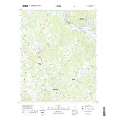
2019 Map of New London
USGS Topo · Published 2019About this map
Albemarle and the northern reaches of Stanly County anchor this modern topographic survey, showing a landscape defined by significant water bodies and the Uwharrie National Forest. The eastern boundary is dominated by the Tuckertown Reservoir and Badin Lake, where the Yadkin River has been harnessed to shape the region's geography. Along the western corridor, the Winston-Salem Southbound railroad line connects the primary settlements of Richfield and New London.
Find a feature on this map
142 named features on this map. Tap any name to fly to it.
Don’t see what you’re looking for? This feature index may not catch every label — zoom into the map to look around manually.
Map Details
Editions of this 2019 New London Map
This is the sole edition of this map. No revisions or reprints were ever made.
Other maps of this area

1949 · High Rock
USGS Topo · 1:24,000

1953 · Charlotte
USGS Topo · 1:250,000

1954 · Charlotte
USGS Topo · 1:250,000

1957 · Mount Pleasant
USGS Topo · 1:62,500

1957 · Albemarle
USGS Topo · 1:62,500

1957 · Denton
USGS Topo · 1:62,500

1960 · Charlotte
USGS Topo · 1:250,000

1962 · Charlotte
USGS Topo · 1:250,000
1962 · Gold Hill
USGS Topo · 1:24,000
1977 · High Rock
USGS Topo · 1:24,000