2023 Map of New Martinsville
USGS Topo · Published 2023About this map
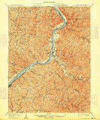
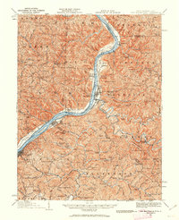
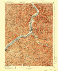
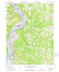
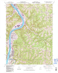
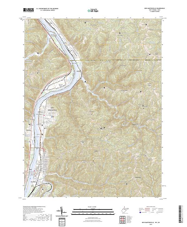
The Wetzel County Courthouse stands as the civic heart of New Martinsville, situated along the eastern bank of the Ohio River as it winds through a region defined by complex ridges and bottomlands. Industrial activity and land management are visible through features like the 3b-3a-Slurry Impoundments 3 and the proposed Ohio River - Middle Ohio River Trail, reflecting the area's transition toward recreational reuse of river-side corridors. The landscape is densely packed with genealogical markers, including numerous family and community burial sites such as Wayne Cem, Fairview Cem, and the New Hannibal Cem across the water. Small settlements like Steelton, Natrium, and Proctor dot the riverbanks, while the interior is characterized by a network of high points like Huff Ridge and Friendship Ridge, where isolated churches such as the Apostolic Christian Cemetery serve the surrounding rural community of Green Hill.
Find a feature on this map
135 named features on this map. Tap any name to fly to it.
Don’t see what you’re looking for? This feature index may not catch every label — zoom into the map to look around manually.
Map Details
Editions of this 2023 New Martinsville Map
This is the sole edition of this map. No revisions or reprints were ever made.
Historical Maps of Duffy Through Time
6 maps found