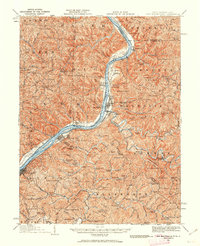
1924 Map of New Martinsville
USGS Topo · Published 1962About this map
The Ohio River serves as the central artery for this 1924 revision, separating West Virginia and Ohio while connecting industrial and agricultural hubs. Along its eastern bank, New Martinsville and Paden City emerge as established riverfront centers, while Sistersville anchors the southern reaches of the sheet. The landscape is defined by the Baltimore and Ohio rail line following the river's edge, passing landmarks like the Hannibal Sta and the County Infirmary.
Find a feature on this map
133 named features on this map. Tap any name to fly to it.
Don’t see what you’re looking for? This feature index may not catch every label — zoom into the map to look around manually.
Map Details
Editions of this 1924 New Martinsville Map
2 editions found

Other maps of this area

1903 · Littleton
USGS Topo · 1:62,500

1904 · Cameron
USGS Topo · 1:62,500

1905 · Centerpoint
USGS Topo · 1:62,500

1905 · West Union
USGS Topo · 1:62,500

1905 · Littleton
USGS Topo · 1:62,500

1905 · Clarington
USGS Topo · 1:62,500

1905 · New Matamoras
USGS Topo · 1:62,500

1905 · Woodsfield
USGS Topo · 1:62,500

1906 · Saint Marys
USGS Topo · 1:62,500

1906 · New Martinsville
USGS Topo · 1:62,500