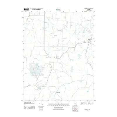
2012 Map of New Melle
USGS Topo · Published 2012About this map
New Melle and its surrounding communities sit within a landscape defined by the winding paths of Dardenne Creek to the north and Femme Osage Creek to the south. This 2012 survey illustrates the transition of Saint Charles County into a region of private lakes and residential developments. Significant water bodies such as Lake Sherwood, Lake Eleanor, and Sugar Hollow Lake dominate the western portion of the map, representing a shift in land use toward recreation and community planning.
Find a feature on this map
90 named features on this map. Tap any name to fly to it.
Don’t see what you’re looking for? This feature index may not catch every label — zoom into the map to look around manually.
Map Details
Editions of this 2012 New Melle Map
This is the sole edition of this map. No revisions or reprints were ever made.
Other maps of this area

1890 · Hermann
USGS Topo · 1:125,000

1903 · O'Fallon
USGS Topo · 1:125,000

1941 · Troy
USGS Topo · 1:62,500

1943 · Warrenton
USGS Topo · 1:62,500

1945 · Troy
USGS Topo · 1:62,500

1945 · Warrenton
USGS Topo · 1:62,500

1948 · Washington
USGS Topo · 1:62,500

1948 · Augusta
USGS Topo · 1:62,500

1949 · Saint Louis
USGS Topo · 1:250,000
1949 · Washington
USGS Topo · 1:62,500