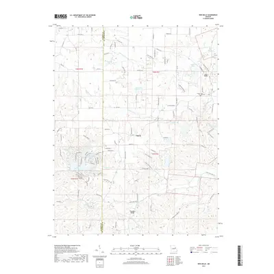
2017 Map of New Melle
USGS Topo · Published 2017About this map
New Melle and its surrounding countryside in southwestern Saint Charles County are defined by a complex network of creeks and small private reservoirs. The settlement patterns of Cappeln and Femme Osage reflect the region's agricultural roots, while the western portion of the map showcases more recent suburban development around Lake Sherwood, where a cluster of small lakes like Lake Alan and Lake Marian sit adjacent to Wolf Creek. Along the county line shared with Warren County, the terrain rises toward Zee Acres Ridge. Local history is anchored by the Friedens Saint Pauls Cem, situated near the eastern edge of the village of New Melle. This 2017 survey by the U.S. Geological Survey illustrates the modern landscape where historic creek names like Dardenne Creek and Femme Osage Creek intersect with newer residential developments.
Find a feature on this map
114 named features on this map. Tap any name to fly to it.
Don’t see what you’re looking for? This feature index may not catch every label — zoom into the map to look around manually.
Map Details
Editions of this 2017 New Melle Map
This is the sole edition of this map. No revisions or reprints were ever made.
Other maps of this area

1890 · Hermann
USGS Topo · 1:125,000

1903 · O'Fallon
USGS Topo · 1:125,000

1941 · Troy
USGS Topo · 1:62,500

1943 · Warrenton
USGS Topo · 1:62,500

1945 · Troy
USGS Topo · 1:62,500

1945 · Warrenton
USGS Topo · 1:62,500

1948 · Washington
USGS Topo · 1:62,500

1948 · Augusta
USGS Topo · 1:62,500

1949 · Saint Louis
USGS Topo · 1:250,000
1949 · Washington
USGS Topo · 1:62,500