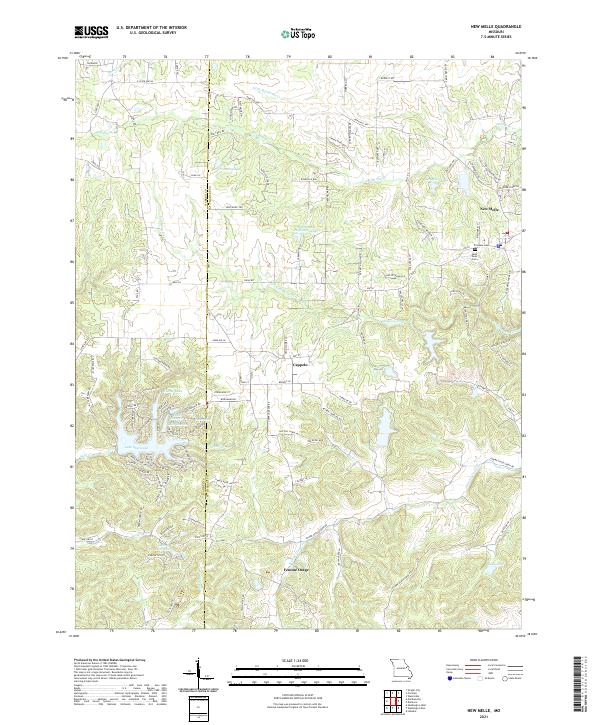
2021 Map of New Melle
USGS Topo · Published 2021About this map
New Melle anchors the northeastern corner of this modern Missouri landscape, where the rolling hills of St. Charles and Warren counties meet. The area is defined by its network of water bodies, including Flemming Lake and the substantial Bonze and Hoffmann Lake, situated among the headwaters of Dardenne Cr. To the south, the terrain descends toward the Femme Osage Creek valley, passing through the historic community of Femme Osage. This region preserves its rural character through numerous named local routes such as Foristell Rd and Point Prairie Rd. For those interested in local heritage, the map identifies Friedens Cem and Saint Pauls Cem near the town centers. The western portion is notably dominated by the residential and recreational development of Lake Sherwood, featuring a series of connected reservoirs including Lake Eleanor and Lake Marion.
Find a feature on this map
118 named features on this map. Tap any name to fly to it.
Don’t see what you’re looking for? This feature index may not catch every label — zoom into the map to look around manually.
Map Details
Editions of this 2021 New Melle Map
This is the sole edition of this map. No revisions or reprints were ever made.
Other maps of this area

1890 · Hermann
USGS Topo · 1:125,000

1903 · O'Fallon
USGS Topo · 1:125,000

1941 · Troy
USGS Topo · 1:62,500

1943 · Warrenton
USGS Topo · 1:62,500

1945 · Troy
USGS Topo · 1:62,500

1945 · Warrenton
USGS Topo · 1:62,500

1948 · Washington
USGS Topo · 1:62,500

1948 · Augusta
USGS Topo · 1:62,500

1949 · Saint Louis
USGS Topo · 1:250,000
1949 · Washington
USGS Topo · 1:62,500