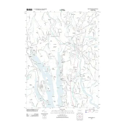
2012 Map of New Milford
USGS Topo · Published 2012About this map
Lake Candlewood dominates the central landscape of this western Connecticut region, with its intricate shoreline forming numerous points and coves including Atchison Cove and Turners Point. To the east, the Housatonic River and the Housatonic Railroad follow the valley floor, passing through the historic centers of Lanesville and Wellsville. The terrain is defined by prominent elevations such as Boardman Mountain and Candlewood Mountain, which overlook the expansive waters and the surrounding agricultural and residential settlements.
Find a feature on this map
298 named features on this map. Tap any name to fly to it.
Don’t see what you’re looking for? This feature index may not catch every label — zoom into the map to look around manually.
Map Details
Editions of this 2012 New Milford Map
This is the sole edition of this map. No revisions or reprints were ever made.
Other maps of this area

1892 · Danbury
USGS Topo · 1:62,500

1892 · New Milford
USGS Topo · 1:62,500

1892 · Carmel
USGS Topo · 1:62,500

1893 · Carmel
USGS Topo · 1:62,500

1893 · New Milford
USGS Topo · 1:62,500

1893 · Clove
USGS Topo · 1:62,500

1894 · Clove
USGS Topo · 1:62,500

1894 · Carmel
USGS Topo · 1:62,500

1898 · Clove
USGS Topo · 1:62,500

1901 · Clove
USGS Topo · 1:62,500