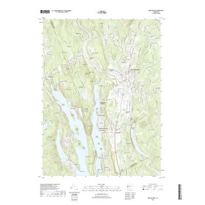
2018 Map of New Milford
USGS Topo · Published 2018About this map
The Housatonic River and the expansive Candlewood Lake define the geography of this western Connecticut landscape. In the town of New Milford, the dense concentration of civil and religious sites includes the Center Cem and Saint Francis Cem, while the southern reaches near Lanesville are marked by the Quaker Cem and the Hill Burying Ground. This survey reveals the complex relationship between the region's prominent hills, such as Candlewood Mtn and Boardman Mtn, and its industrial history, noted by features like The Lime Kiln and the Haviland Millpond. Aviation interests appear at the Candlelight Farms Airport, while the intricate shoreline of the lake creates a series of named points and coves including Candlewood Point and Squantz Cove, illustrating the area's modern development as a recreation and residential hub.
Find a feature on this map
277 named features on this map. Tap any name to fly to it.
Don’t see what you’re looking for? This feature index may not catch every label — zoom into the map to look around manually.
Map Details
Editions of this 2018 New Milford Map
This is the sole edition of this map. No revisions or reprints were ever made.
Other maps of this area

1892 · Danbury
USGS Topo · 1:62,500

1892 · New Milford
USGS Topo · 1:62,500

1892 · Carmel
USGS Topo · 1:62,500

1893 · Carmel
USGS Topo · 1:62,500

1893 · New Milford
USGS Topo · 1:62,500

1893 · Clove
USGS Topo · 1:62,500

1894 · Clove
USGS Topo · 1:62,500

1894 · Carmel
USGS Topo · 1:62,500

1898 · Clove
USGS Topo · 1:62,500

1901 · Clove
USGS Topo · 1:62,500