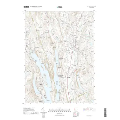
2021 Map of New Milford
USGS Topo · Published 2021About this map
Lake Candlewood dominates this Litchfield and Fairfield County landscape, where the waters of the Housatonic River and Still River meet. The terrain is marked by numerous peaks and ridges named for local families and landmarks, such as Boardman Mtn, Stillson Hill, and Towner Hill. The presence of The Lime Kiln and the Candlelight Farms Airport speaks to the industrial and logistical history of the region. Near the modern center of New Milford, historical sites like the Lovers Leap Bridge and the Gallows Hill Burying Ground reflect the deep-rooted settlement patterns of western Connecticut. This map documents a complex shoreline of inlets and points, including New Milford Bay and Shelter Harbor, alongside established lakeside communities like Candlewood Springs and Birch Groves.
Find a feature on this map
104 named features on this map. Tap any name to fly to it.
Don’t see what you’re looking for? This feature index may not catch every label — zoom into the map to look around manually.
Map Details
Editions of this 2021 New Milford Map
This is the sole edition of this map. No revisions or reprints were ever made.
Other maps of this area

1892 · Danbury
USGS Topo · 1:62,500

1892 · New Milford
USGS Topo · 1:62,500

1892 · Carmel
USGS Topo · 1:62,500

1893 · Carmel
USGS Topo · 1:62,500

1893 · New Milford
USGS Topo · 1:62,500

1893 · Clove
USGS Topo · 1:62,500

1894 · Clove
USGS Topo · 1:62,500

1894 · Carmel
USGS Topo · 1:62,500

1898 · Clove
USGS Topo · 1:62,500

1901 · Clove
USGS Topo · 1:62,500