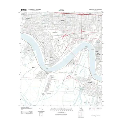
2012 Map of New Orleans West
USGS Topo · Published 2012About this map
Metairie and its surrounding suburbs dominate the northern landscape of this Jefferson Parish region, showing a dense residential grid reaching toward the Mississippi River. The river's winding path is defined by sharp bends and industrial infrastructure, notably the Huey P Long Bridge connecting Bridge City to Elmwood. Along the southern banks, the character of the land shifts toward petroleum extraction and wetlands management, evidenced by the Westwego Oil and Gas Field and the Avondale Oil Field near the Labranche Canal.
Find a feature on this map
66 named features on this map. Tap any name to fly to it.
Don’t see what you’re looking for? This feature index may not catch every label — zoom into the map to look around manually.
Map Details
Editions of this 2012 New Orleans West Map
This is the sole edition of this map. No revisions or reprints were ever made.
Other maps of this area

1891 · Hahnville
USGS Topo · 1:62,500

1891 · Spanish Fort
USGS Topo · 1:62,500

1891 · New Orleans
USGS Topo · 1:62,500

1892 · Bonnet Carre
USGS Topo · 1:62,500

1932 · New Orleans NE
USGS Topo · 1:31,680

1932 · New Orleans NW
USGS Topo · 1:31,680

1932 · New Orleans SE
USGS Topo · 1:31,680

1932 · New Orleans SW
USGS Topo · 1:31,680

1932 · Hahnville NE
USGS Topo · 1:31,680

1935 · Luling
USGS Topo · 1:31,680