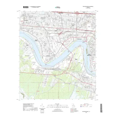
2018 Map of New Orleans West
USGS Topo · Published 2018About this map
The Mississippi River carves a massive S-curve through this landscape, defining the industrial and residential corridors of Jefferson and Orleans Parishes. On the east bank, the established neighborhoods of Kenner, Metairie, and Jefferson are dense with suburban infrastructure, featuring long-standing landmarks like the Garden of Memories Cem and Delgado Community College Jefferson. The river's influence is evident at Carrollton Bend and Ninemile Point, where the Huey P Long Bridge provides a vital link to the west bank communities of Avondale and Westwego. Significant transportation arteries including Airline Dr and the Westbank Expy highlight the region's role as a major transit hub. Further south, the terrain shifts into the marshy reaches of Bayou Segnette and Whisky Bayou, showcasing the proximity of urban development to the coastal wetlands that characterize southern Louisiana's geography.
Find a feature on this map
47 named features on this map. Tap any name to fly to it.
Don’t see what you’re looking for? This feature index may not catch every label — zoom into the map to look around manually.
Map Details
Editions of this 2018 New Orleans West Map
This is the sole edition of this map. No revisions or reprints were ever made.
Other maps of this area

1891 · Hahnville
USGS Topo · 1:62,500

1891 · Spanish Fort
USGS Topo · 1:62,500

1891 · New Orleans
USGS Topo · 1:62,500

1892 · Bonnet Carre
USGS Topo · 1:62,500

1932 · New Orleans NE
USGS Topo · 1:31,680

1932 · New Orleans NW
USGS Topo · 1:31,680

1932 · New Orleans SE
USGS Topo · 1:31,680

1932 · New Orleans SW
USGS Topo · 1:31,680

1932 · Hahnville NE
USGS Topo · 1:31,680

1935 · Luling
USGS Topo · 1:31,680