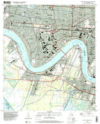
1998 Map of New Orleans West
USGS Topo · Published 2000About this map
The Mississippi River defines the landscape of this Jefferson Parish corridor, carving the deep bends of Greenville Bend and Carrollton Bend while separating established riverfront communities. The late 20th-century urban expansion is evident across Metairie, Kenner, and Harahan, where dense residential grids are interspersed with numerous parochial institutions like St Christopher Sch and St Mary Magdalen Sch. To the south, the industrial and transport infrastructure dominates the West Bank, anchored by the sprawling Oil and Gas Field and the complex rail networks near Avondale.
Find a feature on this map
68 named features on this map. Tap any name to fly to it.
Don’t see what you’re looking for? This feature index may not catch every label — zoom into the map to look around manually.
Map Details
Editions of this 1998 New Orleans West Map
This is the sole edition of this map. No revisions or reprints were ever made.
Other maps of this area

1891 · Hahnville
USGS Topo · 1:62,500

1891 · Spanish Fort
USGS Topo · 1:62,500

1891 · New Orleans
USGS Topo · 1:62,500

1892 · Bonnet Carre
USGS Topo · 1:62,500

1932 · New Orleans NE
USGS Topo · 1:31,680

1932 · New Orleans NW
USGS Topo · 1:31,680

1932 · New Orleans SE
USGS Topo · 1:31,680

1932 · New Orleans SW
USGS Topo · 1:31,680

1932 · Hahnville NE
USGS Topo · 1:31,680

1935 · Luling
USGS Topo · 1:31,680