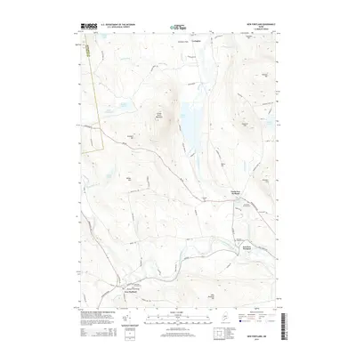
2014 Map of New Portland
USGS Topo · Published 2014About this map
The New Portland Wire Bridge stands as a focal point near the southern edge of this map, crossing the Carrabassett River near the village of New Portland. This area of Maine is defined by a series of settlements including North New Portland, East New Portland, and Lexington, each established along the valleys created by the river and its tributaries like Gilman Stream and Lemon Stream. The terrain is marked by significant elevations such as Gilman Pond Mountain and Millay Hill, which overlook various water bodies like Gilman Pond and Hancock Pond. For genealogists and local historians, several burial grounds are documented, including Greenleaf Cem and the North New Portland Cem. The network of backroads, such as Katie Crotch Rd and Bog Rd, provides a detailed look at the rural connectivity between these valley communities and the surrounding hillsides.
Find a feature on this map
78 named features on this map. Tap any name to fly to it.
Don’t see what you’re looking for? This feature index may not catch every label — zoom into the map to look around manually.
Map Details
Editions of this 2014 New Portland Map
This is the sole edition of this map. No revisions or reprints were ever made.
Other maps of this area

1903 · Bingham
USGS Topo · 1:62,500

1904 · Anson
USGS Topo · 1:62,500

1905 · Bingham
USGS Topo · 1:62,500

1928 · Dead River
USGS Topo · 1:62,500

1930 · Kingfield
USGS Topo · 1:48,000

1931 · Dead River
USGS Topo · 1:48,000

1932 · Kingfield
USGS Topo · 1:62,500

1944 · Dead River
USGS Topo · 1:62,500

1948 · Bangor
USGS Topo · 1:250,000

1949 · Jackman
USGS Topo · 1:250,000