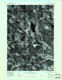
1979 Map of New Portland
USGS Topo · Published 1983About this map
The Carrabassett River carves a winding path through this corner of Somerset County, serving as the central geographic feature for the distinct villages of New Portland, North New Portland, and East New Portland. This orthophotoquad, derived from 1979 aerial imagery, provides a clear visual of the land-use patterns where river valleys meet the wooded uplands. The large expanse of Gilman Pond dominates the central portion of the sheet, feeding into Gilman Stream as it flows south toward the larger river system. Smaller tributaries like Sandy Stream and Lemon Stream define the drainage basins for these rural Maine settlements. The imagery reveals the relationship between the historic village centers and the surrounding timberland, showing the precise footprints of roads and clearings that supported the local economy during the late 1970s.
Find a feature on this map
8 named features on this map. Tap any name to fly to it.
Don’t see what you’re looking for? This feature index may not catch every label — zoom into the map to look around manually.
Map Details
Editions of this 1979 New Portland Map
This is the sole edition of this map. No revisions or reprints were ever made.
Other maps of this area

1903 · Bingham
USGS Topo · 1:62,500

1904 · Anson
USGS Topo · 1:62,500

1905 · Bingham
USGS Topo · 1:62,500

1928 · Dead River
USGS Topo · 1:62,500

1930 · Kingfield
USGS Topo · 1:48,000

1931 · Dead River
USGS Topo · 1:48,000

1932 · Kingfield
USGS Topo · 1:62,500

1944 · Dead River
USGS Topo · 1:62,500

1948 · Bangor
USGS Topo · 1:250,000

1949 · Jackman
USGS Topo · 1:250,000