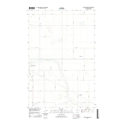
2014 Map of New Rockford NE
USGS Topo · Published 2014About this map
The James River snakes through the center of this landscape, its winding course defining the topography east of New Rockford. This portion of Eddy County is characterized by a grid of rural sections, where the low-lying Tiffany Flats sit between the river valley and the northern prairie. The settlement pattern is anchored by the edge of New Rockford in the west and the small community of Dundas to the southeast, connected by a network of county roads such as 71st Ave NE and 16th St NE. To the south, the wetland area of Schwoebel Slough provides a notable change in terrain. The convergence of Us-281 and Nd-15 near the river crossing highlights the area's role as a regional transit point for the agricultural heartland of central North Dakota.
Find a feature on this map
22 named features on this map. Tap any name to fly to it.
Don’t see what you’re looking for? This feature index may not catch every label — zoom into the map to look around manually.
Map Details
Editions of this 2014 New Rockford NE Map
This is the sole edition of this map. No revisions or reprints were ever made.
Other maps of this area

1928 · Tokio
USGS Topo · 1:62,500

1931 · Oberon
USGS Topo · 1:62,500

1931 · Tokio
USGS Topo · 1:62,500

1944 · Brantford
USGS Topo · 1:62,500

1946 · Brantford
USGS Topo · 1:62,500

1948 · New Rockford
USGS Topo · 1:62,500

1950 · New Rockford
USGS Topo · 1:24,000

1950 · New Rockford NE
USGS Topo · 1:24,000

1950 · Oberon SW
USGS Topo · 1:24,000

1950 · Brantford NW
USGS Topo · 1:24,000